
we use
BLUE UAS and NDAA COMPLIANT DRONES
For every Mapping, Inspection, or Security job, or as requested by the client.
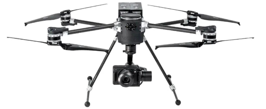
Sentinel Drone Solutions will be using the WISPR SkyScout 2+ platform on these missions.
Prepared today. Protected Tomorrow
Welcome to Sentinel Drone Solutions LLC. We deliver high-precision aerial mapping and actionable spatial intelligence for complex, high-risk, and high-value environments. From optimizing active construction sites to engineering comprehensive situational awareness for critical infrastructure, we provide the definitive data you need to mitigate risk, accelerate timelines, and make critical decisions with absolute confidence. Home of FRIM™ (First Responder Intelligence Mapping).
OUR
Mission
At Sentinel Drone Solutions LLC, our mission is to deliver high-precision, ethically governed aerial intelligence, spatial mapping, inspection, thermal inspection, threat assessment, and security overwatch services that public safety agencies, private-sector partners, and critical infrastructure clients can deploy with absolute confidence.
Our flagship First Responder Intelligence Mapping™ (FRIM™) platform remains central to that mission. FRIM™ delivers secure, highly detailed interior and exterior digital twins engineered for tactical training, pre-incident planning, incident command awareness, and proactive preparedness. Built on a foundation of operational trust, strict data governance, and client-controlled access, FRIM™ is designed to support informed decision-making while protecting privacy, security, and client data ownership.
By combining advanced mapping, verified spatial data, drone-based inspections, thermal intelligence, threat assessment support, and security overwatch capabilities, Sentinel Drone Solutions LLC transforms complex physical environments into clear, actionable intelligence. Our purpose is to help clients identify risks, understand their facilities, protect critical assets, and strengthen operational readiness through legally compliant, secure, and professionally executed aerial and spatial intelligence services.
Why First Responders choose FRIM
First Responder Intelligence Mapping™ (FRIM™) is Sentinel Drone Solutions LLC’s flagship intelligence platform, purpose-built to provide first responders with a deeper understanding of the environments they protect. Combining high-accuracy drone mapping, interior digital twins, and a standardized intelligence labeling framework, FRIM™ converts complex facilities into accessible, searchable, and visually intuitive operational resources. The result is faster orientation, improved situational awareness, reduced uncertainty, and more informed command-level decision-making. Rather than relying solely on static floor plans and fragmented reference materials, agencies gain a unified intelligence resource designed to support preparedness, training, and incident management through accurate mapping and actionable location-based information.
What Is
F R I M?
[First Responder Intelligence Mapping]
FRIM is a comprehensive facility intelligence ecosystem that delivers a precise, visually immersive understanding of your environment to the front lines of crisis management. By putting high-fidelity spatial data directly into the hands of Police, Firefighters, EMS, and Command Staff, FRIM ensures that every responding agency operates with absolute tactical clarity and a unified operational truth.
Exterior mapping and access points
Interior digital twins and navigation
Standardized labeling for clarity
Role-based, secure access
Always current, always available
SENTINEL DRONE SOLUTIONS IS
Built on more than three decades of public safety leadership and high-risk operations, Sentinel's foundation is rooted in real-world crisis management. Our approach to spatial intelligence is directly shaped by an active SWAT Sergeant, bringing unparalleled, front-line insight into tactical preparedness, multi-agency coordination, and critical decision-making. This deep background in Justice Studies and Public Administration ensures a disciplined, standards-driven framework for every mapping asset we build. Read the full story behind our founding and the real-world experiences that inspired the creation of FRIM.
SENTINEL DRONE SOLUTIONS IS
Built on more than three decades of public safety leadership and high-risk operations, Sentinel's foundation is rooted in real-world crisis management. Our approach to spatial intelligence is directly shaped by an active SWAT Sergeant, bringing unparalleled, front-line insight into tactical preparedness, multi-agency coordination, and critical decision-making. This deep background in Justice Studies and Public Administration ensures a disciplined, standards-driven framework for every mapping asset we build. Read the full story behind our founding and the real-world experiences that inspired the creation of FRIM.